60.25790874437227
19.569834397434168
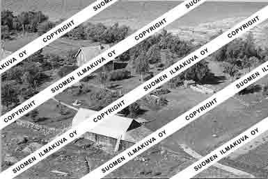
MA1646
https://map.suomenilmakuva.fi/_project/_layout/gfx/purple-pin-small.png
MA1646
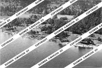
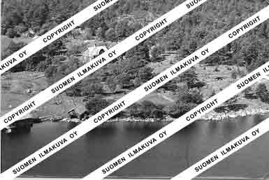
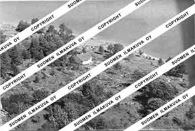
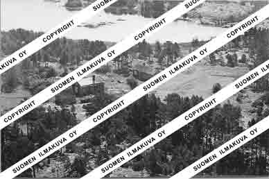
Käringsundby, Framstön, Skag
60.24579542796181
19.537691872819128
MA1646-B01
https://map.suomenilmakuva.fi/_project/_layout/gfx/photo.png
60.24583536175538
19.537860747213276
MA1646-B04
https://map.suomenilmakuva.fi/_project/_layout/gfx/photo.png
60.243769845244586
19.538519884815337
MA1646-B06
https://map.suomenilmakuva.fi/_project/_layout/gfx/photo.png
60.23319660198443
19.543477536310427
MA1646-B07
https://map.suomenilmakuva.fi/_project/_layout/gfx/photo.png
60.2317397562425
19.545456797015838
MA1646-B08
https://map.suomenilmakuva.fi/_project/_layout/gfx/photo.png
60.23632589066754
19.54398190640312
MA1646-B11
https://map.suomenilmakuva.fi/_project/_layout/gfx/photo.png
60.23619287228215
19.54529252249805
MA1646-B12
https://map.suomenilmakuva.fi/_project/_layout/gfx/photo.png
60.23678805520261
19.54947150891704
MA1646-C01
https://map.suomenilmakuva.fi/_project/_layout/gfx/photo.png
60.23451928247417
19.545141961213968
MA1646-C02
https://map.suomenilmakuva.fi/_project/_layout/gfx/photo.png
60.23613162241955
19.54549090119136
MA1646-C03
https://map.suomenilmakuva.fi/_project/_layout/gfx/photo.png
60.23496269745172
19.54904736231344
MA1646-C04
https://map.suomenilmakuva.fi/_project/_layout/gfx/photo.png
60.23447400853529
19.54512029399427
MA1646-C05
https://map.suomenilmakuva.fi/_project/_layout/gfx/photo.png
60.2363651803377
19.543136231423116
MA1646-C06
https://map.suomenilmakuva.fi/_project/_layout/gfx/photo.png
60.23657350722054
19.5428571251292
MA1646-C07
https://map.suomenilmakuva.fi/_project/_layout/gfx/photo.png
60.237016894399844
19.542419820285982
MA1646-C08
https://map.suomenilmakuva.fi/_project/_layout/gfx/photo.png
60.23732047135043
19.54174916325847
MA1646-C09
https://map.suomenilmakuva.fi/_project/_layout/gfx/photo.png
60.23949607031211
19.53944589077381
MA1646-C10
https://map.suomenilmakuva.fi/_project/_layout/gfx/photo.png
60.23941751860489
19.53797057104183
MA1646-C11
https://map.suomenilmakuva.fi/_project/_layout/gfx/photo.png
60.242725846912506
19.537919504296756
MA1646-C12
https://map.suomenilmakuva.fi/_project/_layout/gfx/photo.png
60.24245115927385
19.53368474521072
MA1646-D06
https://map.suomenilmakuva.fi/_project/_layout/gfx/photo.png
60.24813766562547
19.525008292057453
MA1646-D07
https://map.suomenilmakuva.fi/_project/_layout/gfx/photo.png
60.24803118288672
19.525399789799838
MA1646-D08
https://map.suomenilmakuva.fi/_project/_layout/gfx/photo.png
60.24800657488213
19.525473601474573
MA1646-D09
https://map.suomenilmakuva.fi/_project/_layout/gfx/photo.png
60.24638597607027
19.535103496719035
MA1646-D10
https://map.suomenilmakuva.fi/_project/_layout/gfx/photo.png
60.24635136736716
19.535114016007515
MA1646-D11
https://map.suomenilmakuva.fi/_project/_layout/gfx/photo.png
60.24567982115511
19.53302212716105
MA1646-D12
https://map.suomenilmakuva.fi/_project/_layout/gfx/photo.png
60.284396686982376
19.59022778826377
MA1646-E01
https://map.suomenilmakuva.fi/_project/_layout/gfx/photo.png
60.284383391398244
19.590447624629203
MA1646-E02
https://map.suomenilmakuva.fi/_project/_layout/gfx/photo.png
60.28446717361831
19.588892169299104
MA1646-E03
https://map.suomenilmakuva.fi/_project/_layout/gfx/photo.png
60.28440599388808
19.590388511257085
MA1646-E04
https://map.suomenilmakuva.fi/_project/_layout/gfx/photo.png
60.28340341665031
19.590156630536182
MA1646-E05
https://map.suomenilmakuva.fi/_project/_layout/gfx/photo.png
60.28335821026913
19.59022079400496
MA1646-E06
https://map.suomenilmakuva.fi/_project/_layout/gfx/photo.png
60.28297136959125
19.588492084709767
MA1646-E07
https://map.suomenilmakuva.fi/_project/_layout/gfx/photo.png
60.28318144825923
19.587011295785967
MA1646-E08
https://map.suomenilmakuva.fi/_project/_layout/gfx/photo.png
60.28322133646147
19.587300764811996
MA1646-E09
https://map.suomenilmakuva.fi/_project/_layout/gfx/photo.png
60.28311893710136
19.591558257064662
MA1646-E10
https://map.suomenilmakuva.fi/_project/_layout/gfx/photo.png
60.290715854823176
19.591866265331234
MA1646-E11
https://map.suomenilmakuva.fi/_project/_layout/gfx/photo.png
60.290909932224665
19.590648437664683
MA1646-E12
https://map.suomenilmakuva.fi/_project/_layout/gfx/photo.png
60.24558527419566
19.532788641535976
MA1646-F01
https://map.suomenilmakuva.fi/_project/_layout/gfx/photo.png
60.24234998311609
19.533845468204035
MA1646-F02
https://map.suomenilmakuva.fi/_project/_layout/gfx/photo.png
60.242413930448826
19.533912848876835
MA1646-F03
https://map.suomenilmakuva.fi/_project/_layout/gfx/photo.png
60.23695135844024
19.538185163659225
MA1646-F04
https://map.suomenilmakuva.fi/_project/_layout/gfx/photo.png
60.237130535514616
19.538037256621728
MA1646-F05
https://map.suomenilmakuva.fi/_project/_layout/gfx/photo.png
60.259424760381556
19.517690087128603
MA1646-F06
https://map.suomenilmakuva.fi/_project/_layout/gfx/photo.png
60.25946467755645
19.51774362653511
MA1646-F07
https://map.suomenilmakuva.fi/_project/_layout/gfx/photo.png
60.27850124481538
19.473772286322646
MA1646-F08
https://map.suomenilmakuva.fi/_project/_layout/gfx/photo.png
60.278374755027905
19.475136832389627
MA1646-F09
https://map.suomenilmakuva.fi/_project/_layout/gfx/photo.png
60.278510394649814
19.473688229974005
MA1646-F10
https://map.suomenilmakuva.fi/_project/_layout/gfx/photo.png
60.278329541695605
19.475144564695302
MA1646-F11
https://map.suomenilmakuva.fi/_project/_layout/gfx/photo.png
60.278332201305126
19.474640099852923
MA1646-F12
https://map.suomenilmakuva.fi/_project/_layout/gfx/photo.png
60.25779831031024
19.591212053323826
MA1646-G01
https://map.suomenilmakuva.fi/_project/_layout/gfx/photo.png
60.25791806763882
19.590892765677264
MA1646-G02
https://map.suomenilmakuva.fi/_project/_layout/gfx/photo.png
60.257992583088814
19.59126280574753
MA1646-G03
https://map.suomenilmakuva.fi/_project/_layout/gfx/photo.png
60.25327835350044
19.612484992722806
MA1646-G04
https://map.suomenilmakuva.fi/_project/_layout/gfx/photo.png
60.28503233737741
19.5908957684925
MA1646-G08
https://map.suomenilmakuva.fi/_project/_layout/gfx/photo.png
60.2849259746204
19.590930532435905
MA1646-G09
https://map.suomenilmakuva.fi/_project/_layout/gfx/photo.png
60.28338214306692
19.590097202842696
MA1646-G10
https://map.suomenilmakuva.fi/_project/_layout/gfx/photo.png
60.28494192905601
19.5908553258097
MA1646-G11
https://map.suomenilmakuva.fi/_project/_layout/gfx/photo.png
60.25829817242633
19.536001925761838
MA1646-H01
https://map.suomenilmakuva.fi/_project/_layout/gfx/photo.png
60.25831147861461
19.53606887621342
MA1646-H02
https://map.suomenilmakuva.fi/_project/_layout/gfx/photo.png
60.24861339889963
19.526663905838447
MA1646-H03
https://map.suomenilmakuva.fi/_project/_layout/gfx/photo.png
60.248093092198715
19.525232097889443
MA1646-H05
https://map.suomenilmakuva.fi/_project/_layout/gfx/photo.png
60.248541524133046
19.52664234339254
MA1646-H06
https://map.suomenilmakuva.fi/_project/_layout/gfx/photo.png
60.24562520824547
19.532949521689975
MA1646-H07
https://map.suomenilmakuva.fi/_project/_layout/gfx/photo.png
60.24562653937961
19.53293600587111
MA1646-H08
https://map.suomenilmakuva.fi/_project/_layout/gfx/photo.png
60.242427243093026
19.53391542631206
MA1646-H09
https://map.suomenilmakuva.fi/_project/_layout/gfx/photo.png
60.23709873231457
19.53812251210548
MA1646-H10
https://map.suomenilmakuva.fi/_project/_layout/gfx/photo.png
60.246361817564996
19.535185169397135
MA1646-H11
https://map.suomenilmakuva.fi/_project/_layout/gfx/photo.png
60.24494751986061
19.53428223209073
MA1646-H12
https://map.suomenilmakuva.fi/_project/_layout/gfx/photo.png
60.29415397547831
19.592830090291915
MA1646-I01
https://map.suomenilmakuva.fi/_project/_layout/gfx/photo.png
60.2931749178377
19.591140711289146
MA1646-I06
https://map.suomenilmakuva.fi/_project/_layout/gfx/photo.png
60.29322276904696
19.591140501741567
MA1646-I07
https://map.suomenilmakuva.fi/_project/_layout/gfx/photo.png
60.29319884345109
19.590898893382647
MA1646-I08
https://map.suomenilmakuva.fi/_project/_layout/gfx/photo.png


