64.3050933439728
24.54310535465895
Ä04638
https://map.suomenilmakuva.fi/_project/_layout/gfx/red-pin-small.png
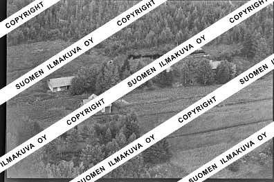
64.30822245164835
24.541930310126556
Ä04638-01
https://map.suomenilmakuva.fi/_project/_layout/gfx/photo.png

64.30706848739703
24.54815602479463
Ä04638-02
https://map.suomenilmakuva.fi/_project/_layout/gfx/photo.png

64.30687527851912
24.549015362111856
Ä04638-03
https://map.suomenilmakuva.fi/_project/_layout/gfx/photo.png

64.30439590526778
24.547921150765365
Ä04638-04
https://map.suomenilmakuva.fi/_project/_layout/gfx/photo.png

64.3043172481429
24.5497077678024
Ä04638-05
https://map.suomenilmakuva.fi/_project/_layout/gfx/photo.png

64.30311640053293
24.549772947633492
Ä04638-06
https://map.suomenilmakuva.fi/_project/_layout/gfx/photo.png

64.30398734531477
24.54091360762001
Ä04638-07
https://map.suomenilmakuva.fi/_project/_layout/gfx/photo.png

64.30371151540444
24.542341053814376
Ä04638-08
https://map.suomenilmakuva.fi/_project/_layout/gfx/photo.png

64.30310002568596
24.545513016580824
Ä04638-09
https://map.suomenilmakuva.fi/_project/_layout/gfx/photo.png

64.29961385679586
24.554788427960144
Ä04638-10
https://map.suomenilmakuva.fi/_project/_layout/gfx/photo.png

64.2993933811449
24.55806497106198
Ä04638-11
https://map.suomenilmakuva.fi/_project/_layout/gfx/photo.png

64.29820595321816
24.555031310949467
Ä04638-12
https://map.suomenilmakuva.fi/_project/_layout/gfx/photo.png

64.29818274991725
24.554918069789135
Ä04638-13
https://map.suomenilmakuva.fi/_project/_layout/gfx/photo.png

64.29559873902404
24.556974533042784
Ä04638-14
https://map.suomenilmakuva.fi/_project/_layout/gfx/photo.png

64.29541725583337
24.558272512658412
Ä04638-15
https://map.suomenilmakuva.fi/_project/_layout/gfx/photo.png

64.29554960476842
24.55712172629653
Ä04638-16
https://map.suomenilmakuva.fi/_project/_layout/gfx/photo.png

64.29561945577868
24.556549724006995
Ä04638-17
https://map.suomenilmakuva.fi/_project/_layout/gfx/photo.png
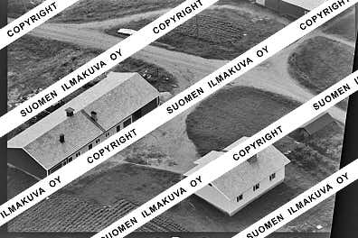
64.29527266949336
24.558174756444007
Ä04638-18
https://map.suomenilmakuva.fi/_project/_layout/gfx/photo.png

64.29629668957703
24.559457641260305
Ä04638-19
https://map.suomenilmakuva.fi/_project/_layout/gfx/photo.png

64.29828202013199
24.55454898361895
Ä04638-20
https://map.suomenilmakuva.fi/_project/_layout/gfx/photo.png

64.30431539760332
24.51059481974048
Ä04638-21
https://map.suomenilmakuva.fi/_project/_layout/gfx/photo.png

64.3022366398344
24.50652403865246
Ä04638-22
https://map.suomenilmakuva.fi/_project/_layout/gfx/photo.png

64.30272233594552
24.50517771674902
Ä04638-23
https://map.suomenilmakuva.fi/_project/_layout/gfx/photo.png

64.30411839623686
24.51032613615454
Ä04638-24
https://map.suomenilmakuva.fi/_project/_layout/gfx/photo.png

64.3026662514285
24.50117563267764
Ä04638-25
https://map.suomenilmakuva.fi/_project/_layout/gfx/photo.png

64.30542040597312
24.500452155669098
Ä04638-26
https://map.suomenilmakuva.fi/_project/_layout/gfx/photo.png

64.30581929001696
24.49850765890709
Ä04638-27
https://map.suomenilmakuva.fi/_project/_layout/gfx/photo.png

64.30419314775929
24.51020525289194
Ä04638-28
https://map.suomenilmakuva.fi/_project/_layout/gfx/photo.png

64.30529796367586
24.500275819892597
Ä04638-29
https://map.suomenilmakuva.fi/_project/_layout/gfx/photo.png

64.30591300112805
24.498753333996003
Ä04638-30
https://map.suomenilmakuva.fi/_project/_layout/gfx/photo.png

64.30423615197833
24.51052037647205
Ä04638-31
https://map.suomenilmakuva.fi/_project/_layout/gfx/photo.png

64.30010582735439
24.500694002972082
Ä04638-32
https://map.suomenilmakuva.fi/_project/_layout/gfx/photo.png

64.29863051911187
24.4918419635134
Ä04638-33
https://map.suomenilmakuva.fi/_project/_layout/gfx/photo.png

64.29765165051097
24.490843356018345
Ä04638-34
https://map.suomenilmakuva.fi/_project/_layout/gfx/photo.png

64.30009929657729
24.50079037021391
Ä04638-35
https://map.suomenilmakuva.fi/_project/_layout/gfx/photo.png

64.29975246724875
24.485673569444355
Ä04638-36
https://map.suomenilmakuva.fi/_project/_layout/gfx/photo.png
