66.2194524797308
27.93136007385366
Ä10302
https://map.suomenilmakuva.fi/_project/_layout/gfx/red-pin-small.png
66.19071
27.88775
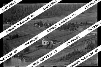
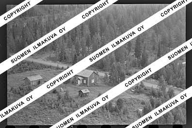
Ä10302-01
https://map.suomenilmakuva.fi/_project/_layout/gfx/photo.png
66.19566018385933
27.885950826530657
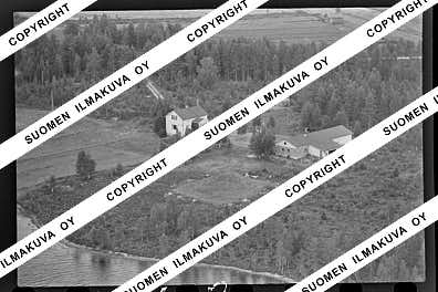
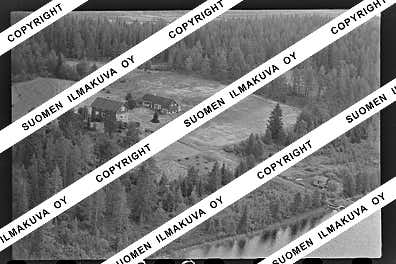
Ä10302-02
https://map.suomenilmakuva.fi/_project/_layout/gfx/photo.png
66.19569915666298
27.864500216164938
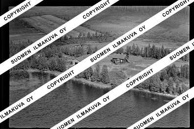
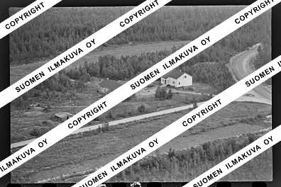
Ä10302-03
https://map.suomenilmakuva.fi/_project/_layout/gfx/photo.png
66.2021001494791
27.889969630212214
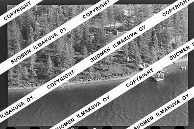
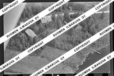
Ä10302-04
https://map.suomenilmakuva.fi/_project/_layout/gfx/photo.png
66.20329231708591
27.89180958424375
Ä10302-05
https://map.suomenilmakuva.fi/_project/_layout/gfx/photo.png
66.20548587875949
27.894702651836038
Ä10302-06
https://map.suomenilmakuva.fi/_project/_layout/gfx/photo.png
66.20870499606018
27.878828470446983
Ä10302-07
https://map.suomenilmakuva.fi/_project/_layout/gfx/photo.png
66.2086804970687
27.861944778631955
Ä10302-08
https://map.suomenilmakuva.fi/_project/_layout/gfx/photo.png
66.21245409089055
27.83902532398967
Ä10302-09
https://map.suomenilmakuva.fi/_project/_layout/gfx/photo.png
66.21254713062484
27.83859956521807
Ä10302-10
https://map.suomenilmakuva.fi/_project/_layout/gfx/photo.png
66.21131845332184
27.840164136382697
Ä10302-11
https://map.suomenilmakuva.fi/_project/_layout/gfx/photo.png
66.21140500581473
27.83998076129606
Ä10302-12
https://map.suomenilmakuva.fi/_project/_layout/gfx/photo.png
66.21468215630489
27.860301339989064
Ä10302-13
https://map.suomenilmakuva.fi/_project/_layout/gfx/photo.png
66.21354093451559
27.86523715602707
Ä10302-14
https://map.suomenilmakuva.fi/_project/_layout/gfx/photo.png
66.21464141064634
27.860710981173035
Ä10302-15
https://map.suomenilmakuva.fi/_project/_layout/gfx/photo.png
66.21447566014007
27.860595190312377
Ä10302-16
https://map.suomenilmakuva.fi/_project/_layout/gfx/photo.png
66.21347948022772
27.865566036078743
Ä10302-17
https://map.suomenilmakuva.fi/_project/_layout/gfx/photo.png
66.21332802561142
27.86928697244417
Ä10302-18
https://map.suomenilmakuva.fi/_project/_layout/gfx/photo.png
66.21383887691198
27.886413117055955
Ä10302-19
https://map.suomenilmakuva.fi/_project/_layout/gfx/photo.png
66.21292042607216
27.893136733965388
Ä10302-20
https://map.suomenilmakuva.fi/_project/_layout/gfx/photo.png
66.2105275317585
27.91280099879142
Ä10302-21
https://map.suomenilmakuva.fi/_project/_layout/gfx/photo.png
66.20838604905984
27.919973562326003
Ä10302-22
https://map.suomenilmakuva.fi/_project/_layout/gfx/photo.png
66.21719219415907
27.917336266218225
Ä10302-23
https://map.suomenilmakuva.fi/_project/_layout/gfx/photo.png
66.2174370555007
27.90437076270257
Ä10302-24
https://map.suomenilmakuva.fi/_project/_layout/gfx/photo.png
66.21759173039229
27.906984931618467
Ä10302-25
https://map.suomenilmakuva.fi/_project/_layout/gfx/photo.png
66.21753115851963
27.904427801553652
Ä10302-26
https://map.suomenilmakuva.fi/_project/_layout/gfx/photo.png
66.22353485937039
27.95406631571104
Ä10302-27
https://map.suomenilmakuva.fi/_project/_layout/gfx/photo.png
66.22978251131092
27.969184961537543
Ä10302-28
https://map.suomenilmakuva.fi/_project/_layout/gfx/photo.png
66.23415035891489
27.9899697690642
Ä10302-29
https://map.suomenilmakuva.fi/_project/_layout/gfx/photo.png
66.23534753168443
28.000686926778997
Ä10302-30
https://map.suomenilmakuva.fi/_project/_layout/gfx/photo.png
66.22928942677572
28.00739078289407
Ä10302-31
https://map.suomenilmakuva.fi/_project/_layout/gfx/photo.png
66.23050392018926
28.000876507142046
Ä10302-32
https://map.suomenilmakuva.fi/_project/_layout/gfx/photo.png
66.22025316104907
28.024657832845094
Ä10302-33
https://map.suomenilmakuva.fi/_project/_layout/gfx/photo.png
66.22107280849056
28.018640903052127
Ä10302-34
https://map.suomenilmakuva.fi/_project/_layout/gfx/photo.png
66.21972258175946
28.024095288700508
Ä10302-35
https://map.suomenilmakuva.fi/_project/_layout/gfx/photo.png
66.21970744008286
28.025169869641857
Ä10302-36
https://map.suomenilmakuva.fi/_project/_layout/gfx/photo.png


