65.9633765
25.0586762
Ä08810
https://map.suomenilmakuva.fi/_project/_layout/gfx/red-pin-small.png
65.9631667
25.0607791
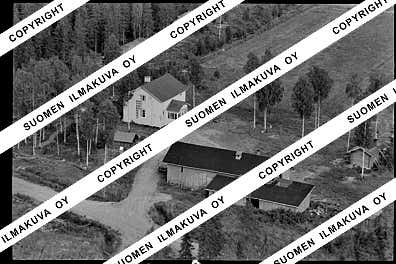
Ä08810-01
https://map.suomenilmakuva.fi/_project/_layout/gfx/photo.png

65.9632891
25.0618090
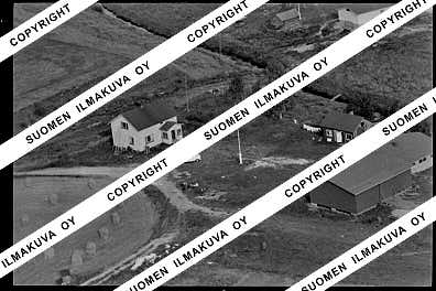
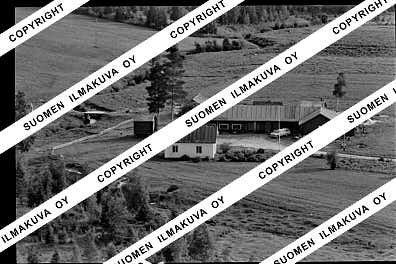
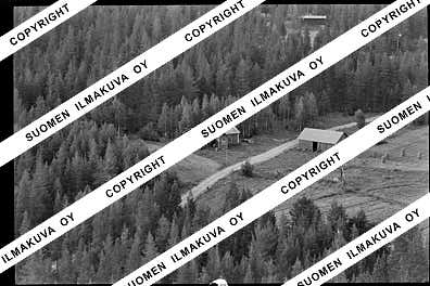
Ä08810-02
https://map.suomenilmakuva.fi/_project/_layout/gfx/photo.png

65.9630365
25.0643875
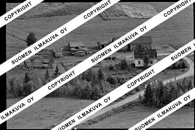
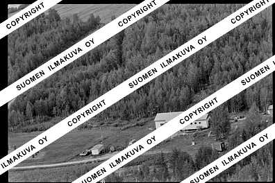
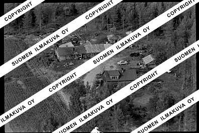
Ä08810-03
https://map.suomenilmakuva.fi/_project/_layout/gfx/photo.png
65.9640058
25.0688042
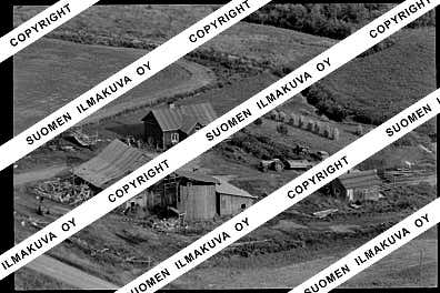
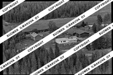
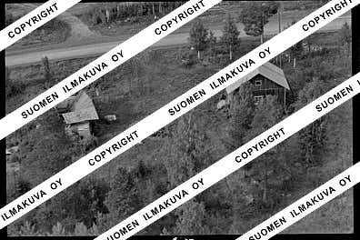
Ä08810-04
https://map.suomenilmakuva.fi/_project/_layout/gfx/photo.png

65.9676872
25.0852946
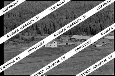
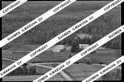
Ä08810-05
https://map.suomenilmakuva.fi/_project/_layout/gfx/photo.png
65.9700675
25.0966274
Ä08810-06
https://map.suomenilmakuva.fi/_project/_layout/gfx/photo.png
65.9716768
25.1033190
Ä08810-07
https://map.suomenilmakuva.fi/_project/_layout/gfx/photo.png
65.9754471
25.1128302
Ä08810-08
https://map.suomenilmakuva.fi/_project/_layout/gfx/photo.png

65.97864771401146
25.130561528998456
Ä08810-09
https://map.suomenilmakuva.fi/_project/_layout/gfx/photo.png

65.9536036
25.1560990
Ä08810-12
https://map.suomenilmakuva.fi/_project/_layout/gfx/photo.png

65.9484014
25.1327122
Ä08810-13
https://map.suomenilmakuva.fi/_project/_layout/gfx/photo.png

65.9491922
25.1442013
Ä08810-14
https://map.suomenilmakuva.fi/_project/_layout/gfx/photo.png

65.9534227
25.1553912
Ä08810-15
https://map.suomenilmakuva.fi/_project/_layout/gfx/photo.png

65.9534019
25.1571784
Ä08810-16
https://map.suomenilmakuva.fi/_project/_layout/gfx/photo.png

65.95255512091795
25.15776574637504
Ä08810-17
https://map.suomenilmakuva.fi/_project/_layout/gfx/photo.png

65.9460352
25.1662676
Ä08810-18
https://map.suomenilmakuva.fi/_project/_layout/gfx/photo.png

65.9463682
25.1638677
Ä08810-19
https://map.suomenilmakuva.fi/_project/_layout/gfx/photo.png
65.9456397
25.1664719
Ä08810-20
https://map.suomenilmakuva.fi/_project/_layout/gfx/photo.png

65.93497
25.13729
Ä08810-21
https://map.suomenilmakuva.fi/_project/_layout/gfx/photo.png

65.93049
25.12241
Ä08810-22
https://map.suomenilmakuva.fi/_project/_layout/gfx/photo.png

65.9220359755338
25.0720083391083
Ä08810-23
https://map.suomenilmakuva.fi/_project/_layout/gfx/photo.png

65.9127355398898
25.07321917688604
Ä08810-25
https://map.suomenilmakuva.fi/_project/_layout/gfx/photo.png

65.91155
25.07582
Ä08810-26
https://map.suomenilmakuva.fi/_project/_layout/gfx/photo.png

65.9148708
25.0749549
Ä08810-27
https://map.suomenilmakuva.fi/_project/_layout/gfx/photo.png
65.91248
25.07286
Ä08810-28
https://map.suomenilmakuva.fi/_project/_layout/gfx/photo.png
65.9152250
25.0739847
Ä08810-29
https://map.suomenilmakuva.fi/_project/_layout/gfx/photo.png
65.9069
25.05654
Ä08810-30
https://map.suomenilmakuva.fi/_project/_layout/gfx/photo.png

65.92038
25.06862
Ä08810-31
https://map.suomenilmakuva.fi/_project/_layout/gfx/photo.png
65.925
25.04827
Ä08810-32
https://map.suomenilmakuva.fi/_project/_layout/gfx/photo.png
65.92573
25.03209
Ä08810-33
https://map.suomenilmakuva.fi/_project/_layout/gfx/photo.png

65.9277810
25.0115718
Ä08810-34
https://map.suomenilmakuva.fi/_project/_layout/gfx/photo.png
65.9271508
25.0111426
Ä08810-35
https://map.suomenilmakuva.fi/_project/_layout/gfx/photo.png


