67.77693917327397
25.247787191671843
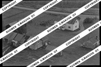
Ä08688
https://map.suomenilmakuva.fi/_project/_layout/gfx/red-pin-small.png
67.77613977508058
25.247315122916852
Ä08688-01
https://map.suomenilmakuva.fi/_project/_layout/gfx/photo.png
67.7750619705859
25.245135242140446
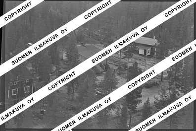
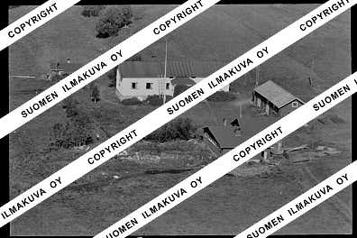
Ä08688-02
https://map.suomenilmakuva.fi/_project/_layout/gfx/photo.png
67.77551782899137
25.24368257556599
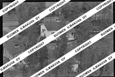
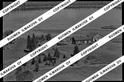
Ä08688-03
https://map.suomenilmakuva.fi/_project/_layout/gfx/photo.png
67.77452586705866
25.237337169845894
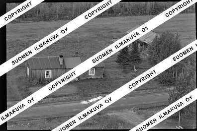
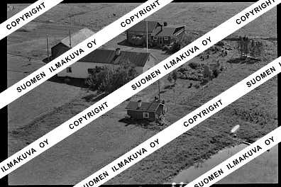
Ä08688-04
https://map.suomenilmakuva.fi/_project/_layout/gfx/photo.png
67.77496098900185
25.237818715379987
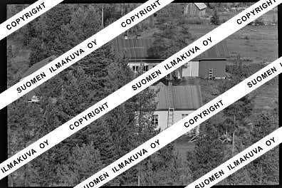
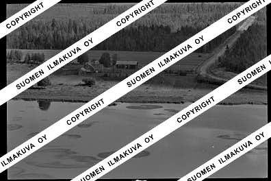
Ä08688-05
https://map.suomenilmakuva.fi/_project/_layout/gfx/photo.png
67.77288
25.23397
Ä08688-06
https://map.suomenilmakuva.fi/_project/_layout/gfx/photo.png
67.77428173986569
25.237460900253264
Ä08688-07
https://map.suomenilmakuva.fi/_project/_layout/gfx/photo.png
67.77393768063476
25.234504745580885
Ä08688-08
https://map.suomenilmakuva.fi/_project/_layout/gfx/photo.png
67.77600005542658
25.246702919581015
Ä08688-09
https://map.suomenilmakuva.fi/_project/_layout/gfx/photo.png
67.77616845984357
25.247577319661275
Ä08688-10
https://map.suomenilmakuva.fi/_project/_layout/gfx/photo.png
67.77636323934506
25.248564372512607
Ä08688-11
https://map.suomenilmakuva.fi/_project/_layout/gfx/photo.png
67.7834654741389
25.23694361091168
Ä08688-12
https://map.suomenilmakuva.fi/_project/_layout/gfx/photo.png
67.78132129046679
25.235235534141676
Ä08688-13
https://map.suomenilmakuva.fi/_project/_layout/gfx/photo.png
67.78047353575177
25.236227725855187
Ä08688-14
https://map.suomenilmakuva.fi/_project/_layout/gfx/photo.png
67.78093184952674
25.233854001465925
Ä08688-15
https://map.suomenilmakuva.fi/_project/_layout/gfx/photo.png
67.78332667094476
25.234076898533935
Ä08688-16
https://map.suomenilmakuva.fi/_project/_layout/gfx/photo.png
67.78472428811715
25.23380648340582
Ä08688-17
https://map.suomenilmakuva.fi/_project/_layout/gfx/photo.png
67.79034823100062
25.2414363012752
Ä08688-18
https://map.suomenilmakuva.fi/_project/_layout/gfx/photo.png
67.787245301158
25.232843855890657
Ä08688-19
https://map.suomenilmakuva.fi/_project/_layout/gfx/photo.png
67.78856658916645
25.23173273789151
Ä08688-20
https://map.suomenilmakuva.fi/_project/_layout/gfx/photo.png
67.78973146137061
25.230795130547715
Ä08688-21
https://map.suomenilmakuva.fi/_project/_layout/gfx/photo.png
67.79105
25.22978
Ä08688-22
https://map.suomenilmakuva.fi/_project/_layout/gfx/photo.png
67.78917591552677
25.232662786801928
Ä08688-23
https://map.suomenilmakuva.fi/_project/_layout/gfx/photo.png
67.79105
25.22978
Ä08688-24
https://map.suomenilmakuva.fi/_project/_layout/gfx/photo.png
67.7878602495979
25.233976288093203
Ä08688-25
https://map.suomenilmakuva.fi/_project/_layout/gfx/photo.png
67.78533454568579
25.235019691306206
Ä08688-26
https://map.suomenilmakuva.fi/_project/_layout/gfx/photo.png
67.78408649292471
25.235592754325435
Ä08688-27
https://map.suomenilmakuva.fi/_project/_layout/gfx/photo.png
67.78923625092028
25.229464435109268
Ä08688-28
https://map.suomenilmakuva.fi/_project/_layout/gfx/photo.png
67.78842755035804
25.248539443654924
Ä08688-32
https://map.suomenilmakuva.fi/_project/_layout/gfx/photo.png
67.79105646751275
25.24858830235717
Ä08688-33
https://map.suomenilmakuva.fi/_project/_layout/gfx/photo.png
67.78916377867658
25.247027204009488
Ä08688-34
https://map.suomenilmakuva.fi/_project/_layout/gfx/photo.png
67.79463107677208
25.25557472685579
Ä08688-35
https://map.suomenilmakuva.fi/_project/_layout/gfx/photo.png
67.79497241100503
25.258988950261223
Ä08688-36
https://map.suomenilmakuva.fi/_project/_layout/gfx/photo.png


