66.78576705663114
25.422274374758537
Ä08673
https://map.suomenilmakuva.fi/_project/_layout/gfx/red-pin-small.png
66.78536
25.41966
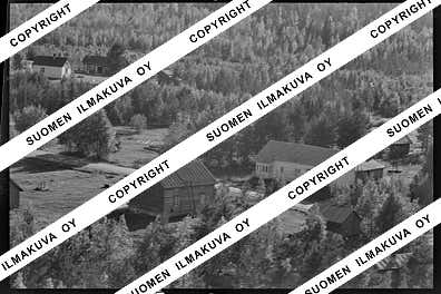
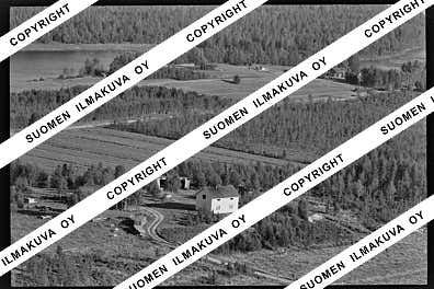
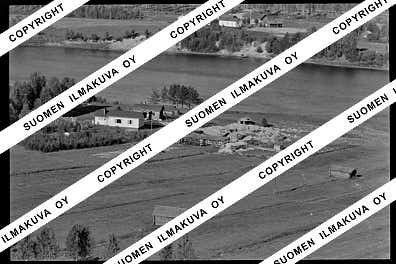
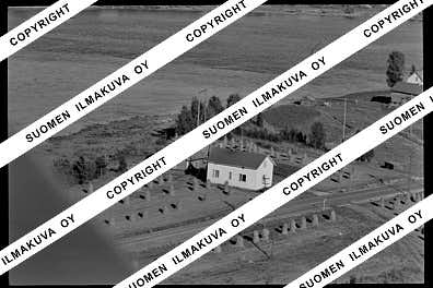
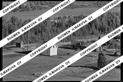
Ä08673-01
https://map.suomenilmakuva.fi/_project/_layout/gfx/photo.png

66.78778
25.41803
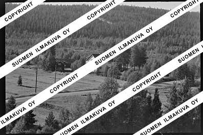
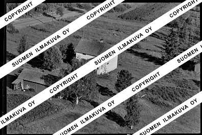
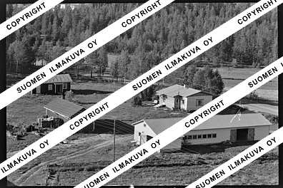
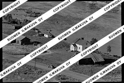
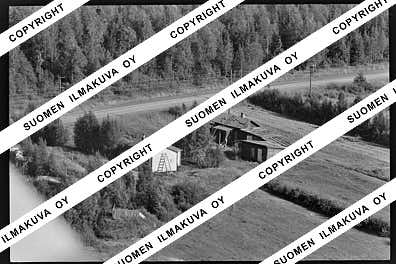
Ä08673-02
https://map.suomenilmakuva.fi/_project/_layout/gfx/photo.png
66.79414
25.41407
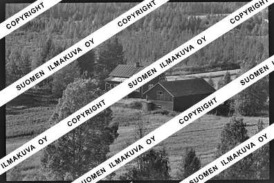
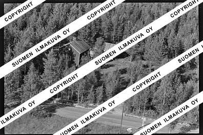
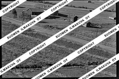
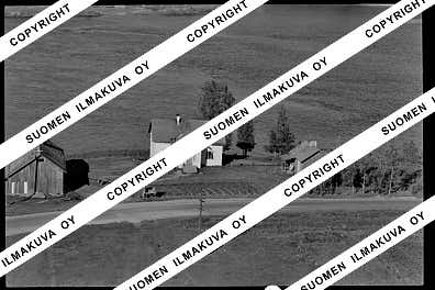
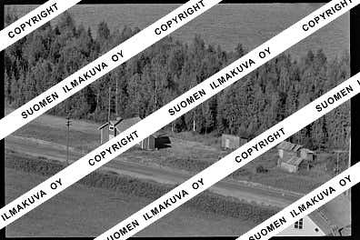
Ä08673-03
https://map.suomenilmakuva.fi/_project/_layout/gfx/photo.png
66.79421
25.41628
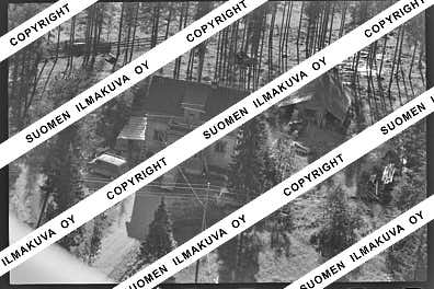
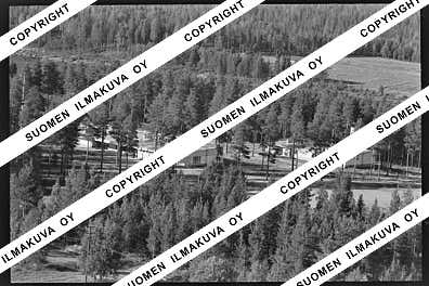
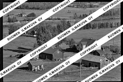
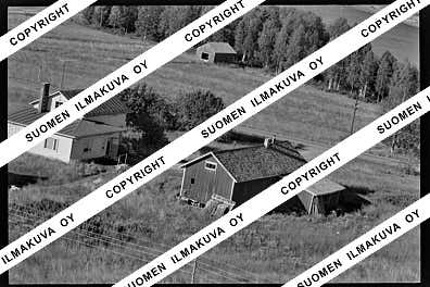
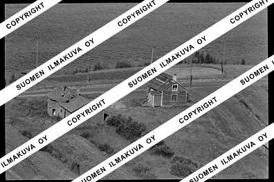
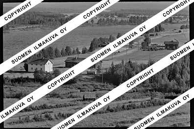
Ä08673-04
https://map.suomenilmakuva.fi/_project/_layout/gfx/photo.png

66.80341
25.41202
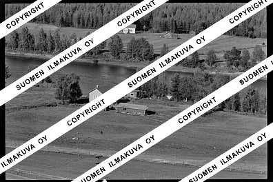
Ä08673-05
https://map.suomenilmakuva.fi/_project/_layout/gfx/photo.png
66.80341
25.41202
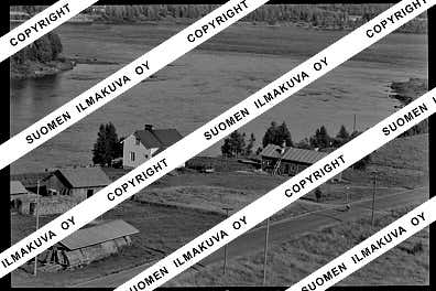
Ä08673-06
https://map.suomenilmakuva.fi/_project/_layout/gfx/photo.png

66.80341
25.41202
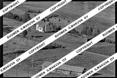
Ä08673-07
https://map.suomenilmakuva.fi/_project/_layout/gfx/photo.png
66.79869
25.41052
Ä08673-08
https://map.suomenilmakuva.fi/_project/_layout/gfx/photo.png

66.78353
25.41967
Ä08673-09
https://map.suomenilmakuva.fi/_project/_layout/gfx/photo.png

66.78778
25.41803
Ä08673-10
https://map.suomenilmakuva.fi/_project/_layout/gfx/photo.png

66.78533
25.41989
Ä08673-11
https://map.suomenilmakuva.fi/_project/_layout/gfx/photo.png

66.78349
25.4204
Ä08673-12
https://map.suomenilmakuva.fi/_project/_layout/gfx/photo.png
66.78045
25.42289
Ä08673-13
https://map.suomenilmakuva.fi/_project/_layout/gfx/photo.png
66.78068
25.42536
Ä08673-14
https://map.suomenilmakuva.fi/_project/_layout/gfx/photo.png
66.78191
25.42532
Ä08673-15
https://map.suomenilmakuva.fi/_project/_layout/gfx/photo.png
66.7796
25.43289
Ä08673-16
https://map.suomenilmakuva.fi/_project/_layout/gfx/photo.png
66.77885
25.42635
Ä08673-17
https://map.suomenilmakuva.fi/_project/_layout/gfx/photo.png
66.77735
25.42918
Ä08673-18
https://map.suomenilmakuva.fi/_project/_layout/gfx/photo.png
66.77317699336189
25.433379909367194
Ä08673-19
https://map.suomenilmakuva.fi/_project/_layout/gfx/photo.png
66.7741979874203
25.431306808064335
Ä08673-20
https://map.suomenilmakuva.fi/_project/_layout/gfx/photo.png
66.77211558722139
25.43638918050036
Ä08673-21
https://map.suomenilmakuva.fi/_project/_layout/gfx/photo.png

66.76941329817623
25.4346263682238
Ä08673-22
https://map.suomenilmakuva.fi/_project/_layout/gfx/photo.png
66.76863908979415
25.437648227433957
Ä08673-23
https://map.suomenilmakuva.fi/_project/_layout/gfx/photo.png
66.76936382351657
25.437812068728775
Ä08673-25
https://map.suomenilmakuva.fi/_project/_layout/gfx/photo.png
66.76633197611127
25.44261136734995
Ä08673-26
https://map.suomenilmakuva.fi/_project/_layout/gfx/photo.png
66.76796517041593
25.439040520437107
Ä08673-27
https://map.suomenilmakuva.fi/_project/_layout/gfx/photo.png
66.76510986483973
25.44590722998884
Ä08673-28
https://map.suomenilmakuva.fi/_project/_layout/gfx/photo.png
66.76380621255541
25.445356485558985
Ä08673-29
https://map.suomenilmakuva.fi/_project/_layout/gfx/photo.png
66.75988514134335
25.448296434482817
Ä08673-31
https://map.suomenilmakuva.fi/_project/_layout/gfx/photo.png
66.75862336633249
25.447376252631027
Ä08673-32
https://map.suomenilmakuva.fi/_project/_layout/gfx/photo.png
66.75980664540148
25.449328900702202
Ä08673-33
https://map.suomenilmakuva.fi/_project/_layout/gfx/photo.png

66.75914198402472
25.4477410330718
Ä08673-34
https://map.suomenilmakuva.fi/_project/_layout/gfx/photo.png
66.75464111439582
25.447216997868253
Ä08673-35
https://map.suomenilmakuva.fi/_project/_layout/gfx/photo.png


