61.76068006375057
22.504733488599562
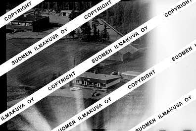
Ä08472
https://map.suomenilmakuva.fi/_project/_layout/gfx/red-pin-small.png
61.75976701486718
22.50422258471238
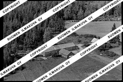
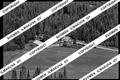
Ä08472-01
https://map.suomenilmakuva.fi/_project/_layout/gfx/photo.png

61.76133
22.50095
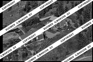
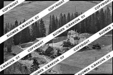
Ä08472-02
https://map.suomenilmakuva.fi/_project/_layout/gfx/photo.png
61.7607661
22.4996633
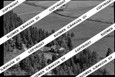
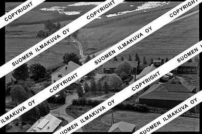
Ä08472-03
https://map.suomenilmakuva.fi/_project/_layout/gfx/photo.png
61.7560650
22.5076563
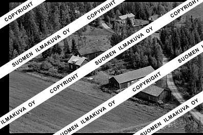
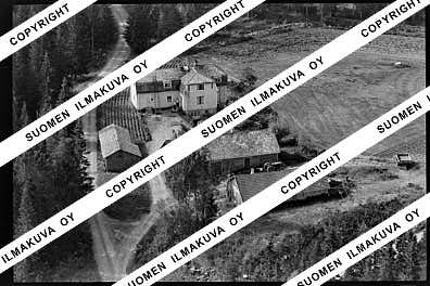
Ä08472-04
https://map.suomenilmakuva.fi/_project/_layout/gfx/photo.png
61.754849932838255
22.508032273360154
Ä08472-06
https://map.suomenilmakuva.fi/_project/_layout/gfx/photo.png

61.75331
22.50869
Ä08472-07
https://map.suomenilmakuva.fi/_project/_layout/gfx/photo.png
61.7564802500916
22.504499192578887
Ä08472-08
https://map.suomenilmakuva.fi/_project/_layout/gfx/photo.png
61.75600055486334
22.496856057033057
Ä08472-10
https://map.suomenilmakuva.fi/_project/_layout/gfx/photo.png

61.756875266045725
22.495175420822694
Ä08472-11
https://map.suomenilmakuva.fi/_project/_layout/gfx/photo.png

61.75683454413527
22.49277451833159
Ä08472-12
https://map.suomenilmakuva.fi/_project/_layout/gfx/photo.png
61.75551003351641
22.49645240167323
Ä08472-14
https://map.suomenilmakuva.fi/_project/_layout/gfx/photo.png
61.762801208975425
22.48495160132557
Ä08472-17
https://map.suomenilmakuva.fi/_project/_layout/gfx/photo.png
61.7598272
22.4881622
Ä08472-18
https://map.suomenilmakuva.fi/_project/_layout/gfx/photo.png
61.75093914375099
22.50336577871265
Ä08472-22
https://map.suomenilmakuva.fi/_project/_layout/gfx/photo.png
61.750524456577494
22.502696203933198
Ä08472-24
https://map.suomenilmakuva.fi/_project/_layout/gfx/photo.png
61.74966490622526
22.501900320961965
Ä08472-25
https://map.suomenilmakuva.fi/_project/_layout/gfx/photo.png
61.74946188187348
22.489246861661346
Ä08472-26
https://map.suomenilmakuva.fi/_project/_layout/gfx/photo.png
61.75237693538078
22.500878665560347
Ä08472-27
https://map.suomenilmakuva.fi/_project/_layout/gfx/photo.png
61.75331
22.50869
Ä08472-28
https://map.suomenilmakuva.fi/_project/_layout/gfx/photo.png
61.7529799154861
22.50183353190566
Ä08472-29
https://map.suomenilmakuva.fi/_project/_layout/gfx/photo.png

61.747471633705494
22.511888605979514
Ä08472-31
https://map.suomenilmakuva.fi/_project/_layout/gfx/photo.png
61.74891534703669
22.516391541204094
Ä08472-32
https://map.suomenilmakuva.fi/_project/_layout/gfx/photo.png
61.74868690203286
22.51898572361937
Ä08472-33
https://map.suomenilmakuva.fi/_project/_layout/gfx/photo.png
61.7478108680524
22.519194935908516
Ä08472-34
https://map.suomenilmakuva.fi/_project/_layout/gfx/photo.png
61.74720749853052
22.5202372099268
Ä08472-38
https://map.suomenilmakuva.fi/_project/_layout/gfx/photo.png
61.746717462663405
22.511273327338138
Ä08472-39
https://map.suomenilmakuva.fi/_project/_layout/gfx/photo.png
61.74497093029866
22.512299333060994
Ä08472-40
https://map.suomenilmakuva.fi/_project/_layout/gfx/photo.png
61.747096164679704
22.50514495748196
Ä08472-41
https://map.suomenilmakuva.fi/_project/_layout/gfx/photo.png

61.745779949495166
22.51546739258871
Ä08472-42
https://map.suomenilmakuva.fi/_project/_layout/gfx/photo.png
61.74113
22.52314
Ä08472-43
https://map.suomenilmakuva.fi/_project/_layout/gfx/photo.png
61.7428
22.52383
Ä08472-44
https://map.suomenilmakuva.fi/_project/_layout/gfx/photo.png


